Track where you can find cell service anywhere in the United States including Alaska, Hawaii, and Puerto Rico with the new Cell Phone Coverage maps in your Gaia GPS App. Now you no longer need to worry about unexpectedly losing signal. These seven new overlays define where major cell phone carriers reach across the country.
Whether you’re headed to the national parks, planning a thru-hike, or going into the backcountry for a few nights, use these maps to find out if you’ll be able to send texts, make calls, or access the internet anywhere you plan to go in the US.
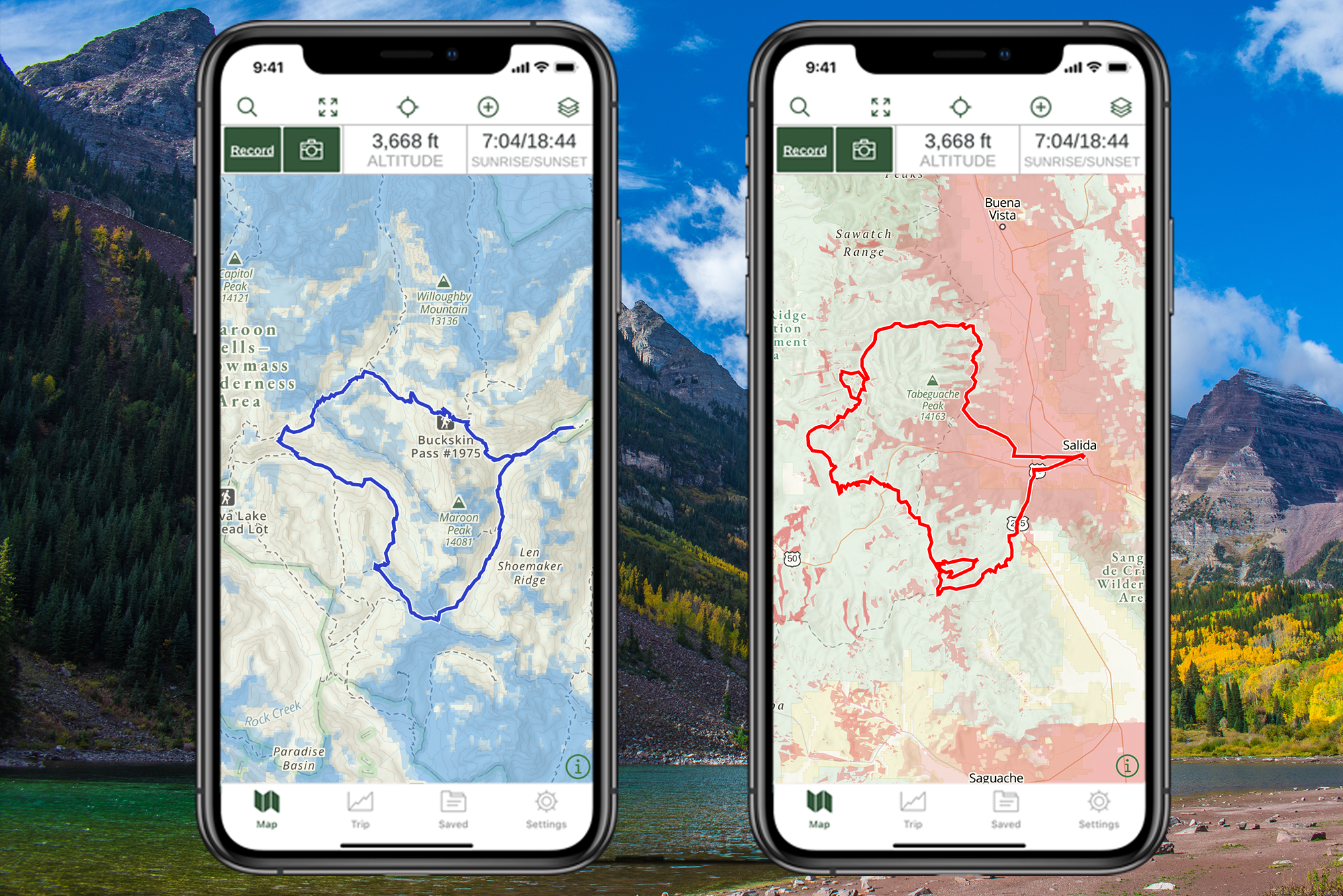
The new Cell Phone Coverage maps include unique maps for AT&T, Verizon, Sprint, T-Mobile, U.S. Cellular, Southern Linc, and all carriers combined in the Continental US, Hawaii, Alaska, and Puerto Rico. Each map delineates voice and broadband coverage for 3G, 4G, and LTE as indicated by the color opacity. The lightest colors represent 3G and the darkest representing LTE.
To view coverage for Alaska carriers including ASTAC, Bristol Bay Telephone Coop Inc., Copper Valley Telecom, Cordova, Telecom Coop, GCI, OTZ Telecom, TelAlaska, and Windy City Cellular, view the “All Carriers” map.
Take Cell Phone Coverage maps with you by downloading them before you go with a Premium account. To view the maps, select the layers icon on the Gaia GPS iOS and Android apps or on gaiagps.com, then select “add map layers.” Next, visit “Feature/Weather Overlays” and look for “Cell coverage” and then select from AT&T, Verizon, Sprint, T-Mobile, U.S. Cellular, Southern Linc, or Cell Coverage – All Carriers maps.
Get the Gaia GPS app on your smartphone or tablet and start exploring today. Access hundreds of map sources across the globe. Get all 250+ with a Premium account with UTVGuide discount.