

By Jon Crowley, UTVGuide.net
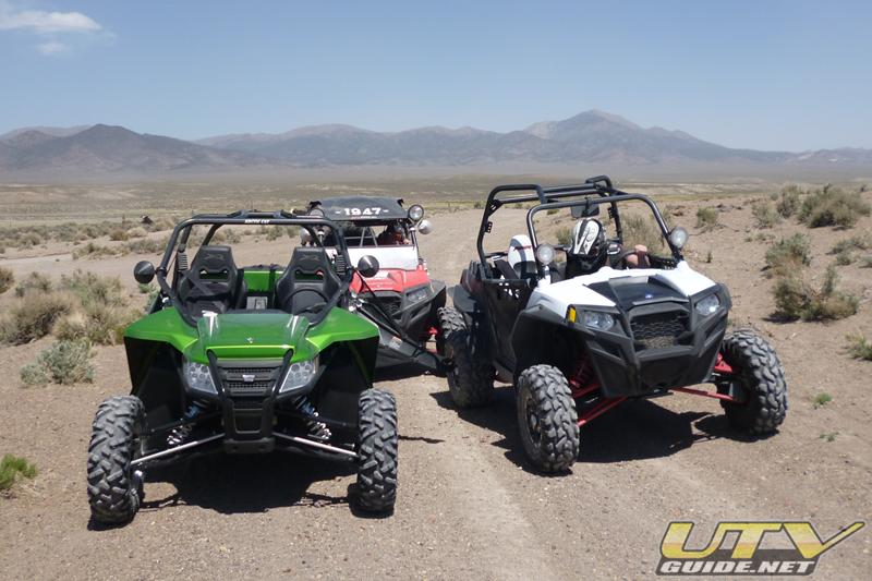
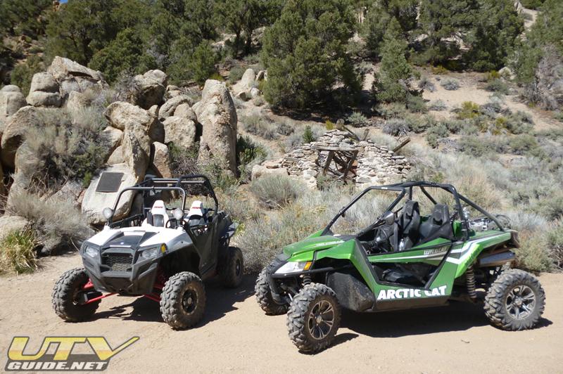
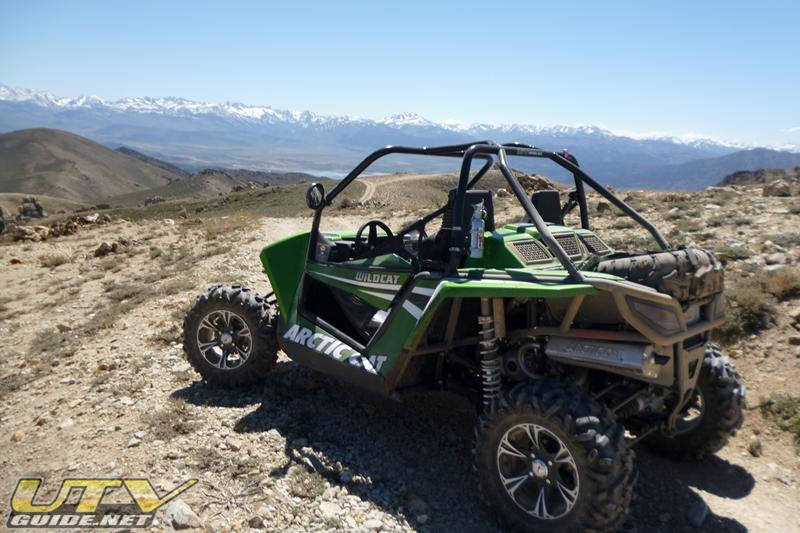
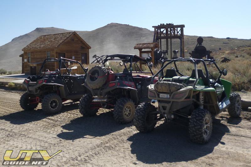
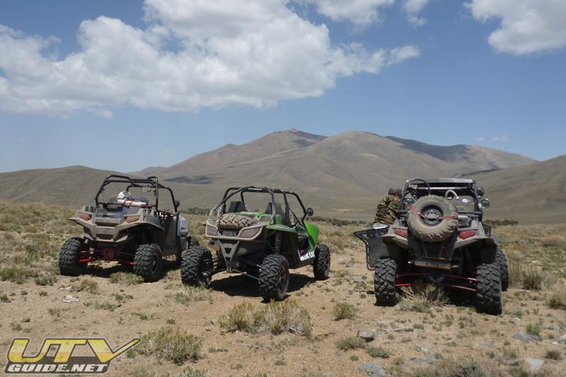
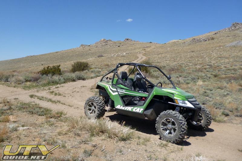
We spent three days exploring northern Nevada in our UTVs. I brought our Arctic Cat Wildcat demo unit, and my friends John and Dave both had their Polaris RZR XPs. We camped along the East Walker River at a place called The Elbow (Google Maps). The East Walker River is known for its remarkable fly fishing, but we chose this location because of the proximity to so many interesting places to ride all within a day.
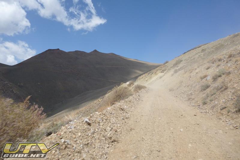
We drove south from Wellington, NV past Sweetwater and turned off onto a dirt road that is designated by the Forest Service at NF 028. Our camp was just a small dirt area off the main road about seven miles in off the highway at a place called The Elbow. Nothing fancy, but we were there to ride so all was well.
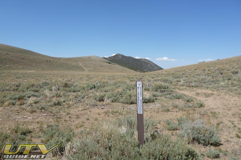
One thing to note about exploring this area. Trail/Road markers are few and far between. A good topo map or Forest Service map is a must, but we would not have been able to cover the ground we did without our Lowrance Baja 540c loaded with the area roads. There are just too many different unmarked roads that dead-end at various mines in the area. I have listed some Forest Service designations where possible, but do not expect to see many of these on the ground.
There are a ton of places to explore from this area. UTVs are ideal for covering some of these rough, narrow roads at a fast pace. Other potential spots to use for base camps are the town of Coleville or Bridgeport. Both have motels and have access to many of the same areas. And if you would rather have a guided experience, you should check out theEastern Sierra ATV & UTV Jamboree that is based out of Coleville.
Day One –
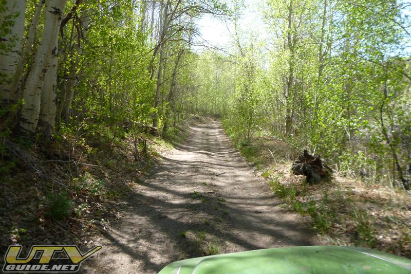
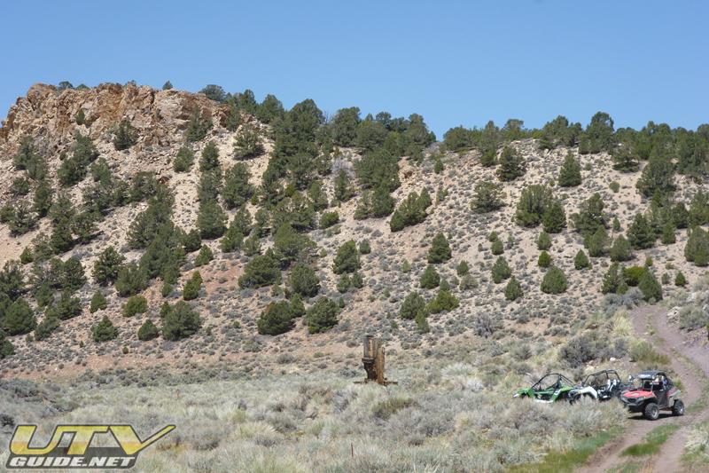
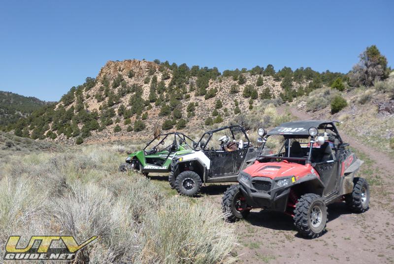
We arrived at our camp about noon and quickly unloaded and hit the trail. We headed east on NF 028 toward Fletcher and Hawthorne, then turned south onto NF 045 (may also be known as Boundary Rd.). We climbed out of the sagebrush and into the Pinion Pines as we drove towards China Camp. We never did find China Camp, but it was fun riding and interesting terrain.
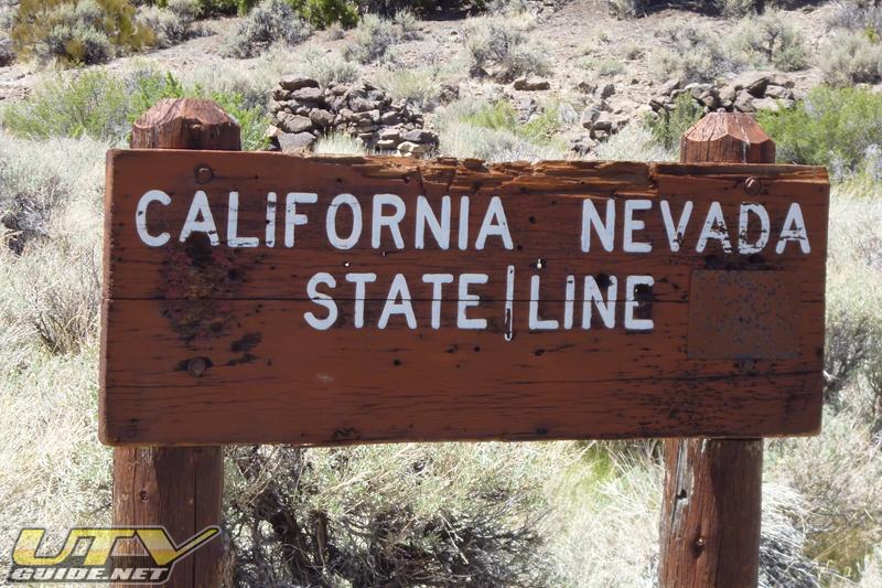
We crossed into California and the road changes to NF 168 and also Cow Camp Rd. We hooked a right on an unnamed road and headed towards Masonic Mountain. There are several roads that can get you over in this direction, we just chose one that looked interesting.
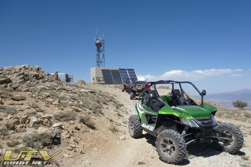
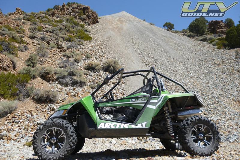
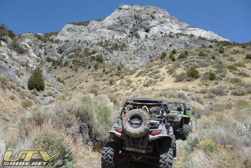
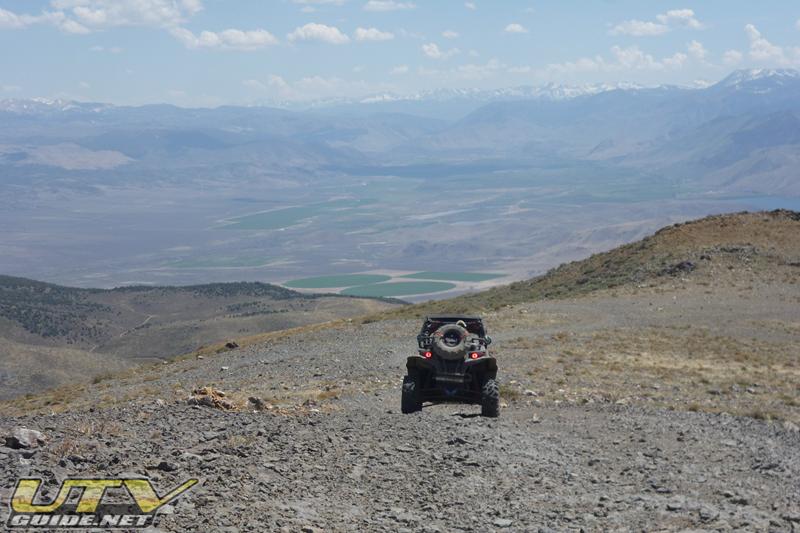
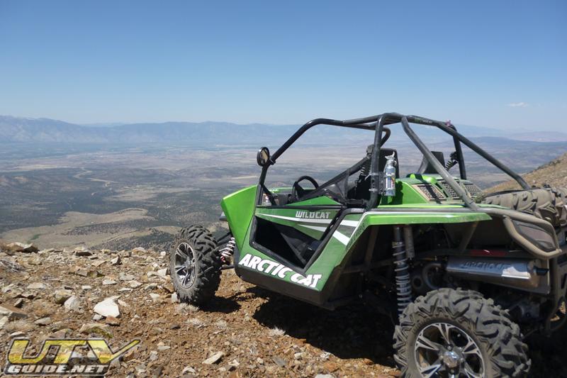
We connected up with Bodie-Masonic Rd. (NF 169) and headed back north towards Masonic. Along the way, we saw a super steep hill climb to the top of Masonic Mountain and decided to go see what the view was like. The ascent was a 4-wheel-drive, low gear climb for about 1,000 feet, but the view was spectacular. There is some radio equipment at the top and we had a nice view of Bridgeport Reservoir to the south-west. From on top of the mountain, we also got nice cell phone service!
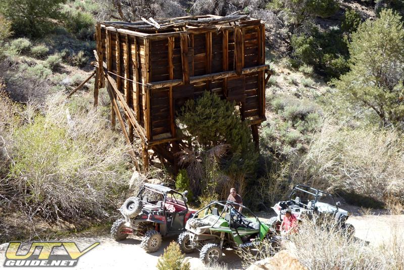
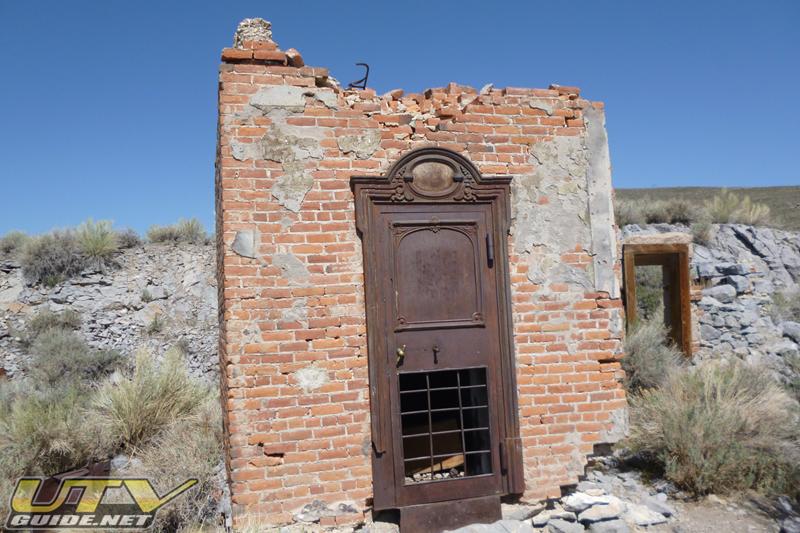
After descending the mountain, we headed south towards Masonic (Upper, Middle and Lower Town) on Masonic Rd. (NF 046). Gold was discovered in Masonic in 1860, but nothing major developed until about 1900. The town was split into Upper, Middle and Lower Town and the population peaked at about 1,000. Nothing is really left in Upper town, but Middle Town has a hopper and lower town has several structures still standing.
We continued on NF 046 back to the main road and headed east back to our camp at The Elbow. It was a nice loop of about 40 miles that took us about 4 hours to complete.


Day Two –

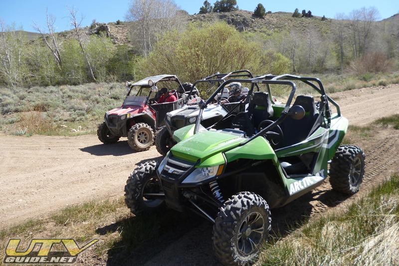
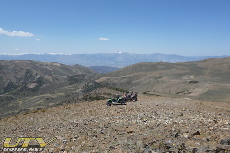
Since we had a full day to explore, I busted out the topo map and outlined a nice 120+ mile loop. We headed west back towards Sweetwater for a few miles then took a left on NF 128. This trail lead us up in elevation and into the pinion pines towards Dome Hill. From there, we headed back over to Masonic and south on Bodie-Masonic Rd. (NF 169). We stayed on this road until we reached Bodie. Most of the area was open, high desert once we hit Masonic Mountain, but there were several turns and choices to make along the way. Once again, GPS with roads downloaded is a huge asset.
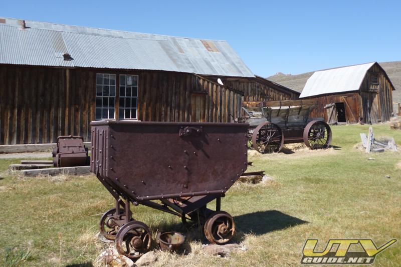
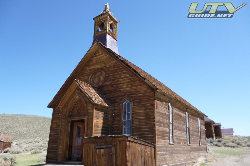
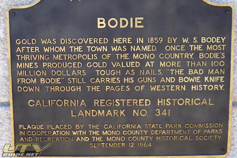
We arrive in Bodie CA (Google Maps) from the back side. It was pretty cool to ride UTVs into a state park. Especially one in California. Bodie is a huge ghost town and is protected. Lots of old buildings, many with old furniture and supplies still in place. If you have never been there, it is well worth the destination. Most people arrive via car from highway 395, so don’t expect to be alone.


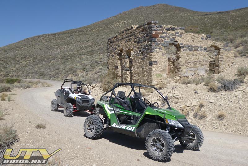
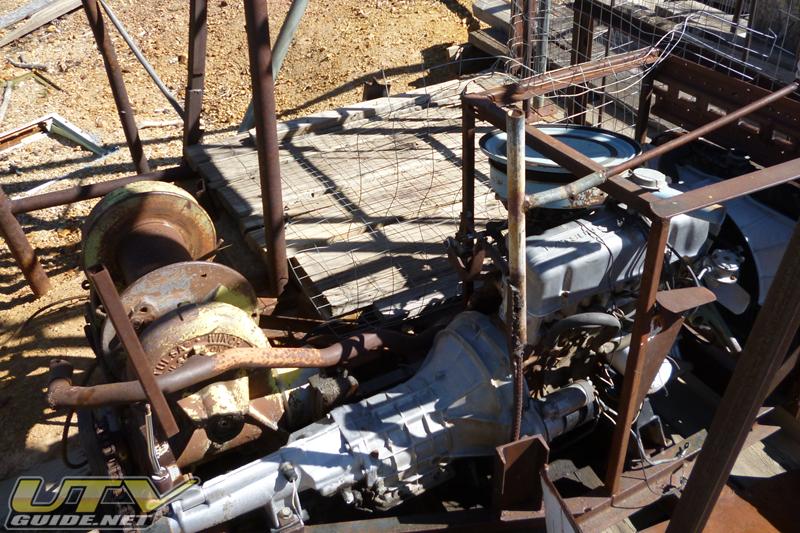
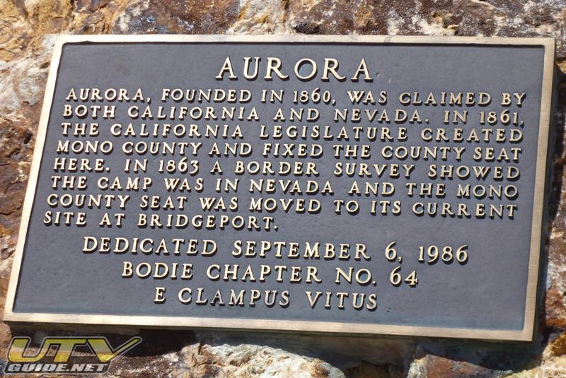
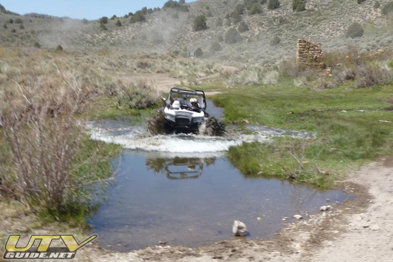
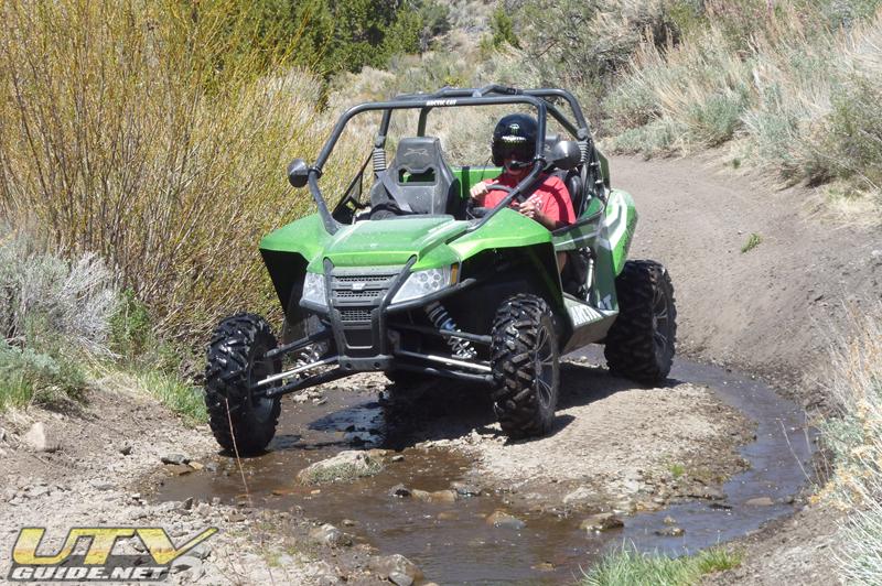
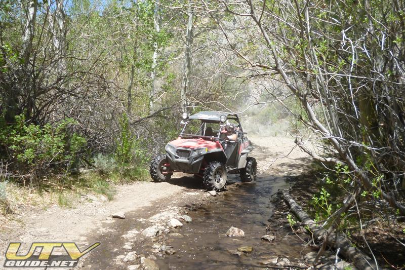
From Bodie, we headed towards Aurora on Bodie Rd. The trail goes into a neat canyon with a few creek crossings. We took a right turn at one point on a road that does not appear to have a Forest Service designation, but it was on our topo map and GPS. This took us into the historic mining town of Aurora, NV. Much of the town has disappeared into the sagebrush, but a nice stamp mill still stands. After wandering around for a while, we decided to try and work our way through the area and out another way. Well that turned out to be tougher than expected. The area has several old mines and more buildings that are interesting to check out, but new mining efforts are underway, and what shows up on the GPS, often turned into a dead end at a locked gate.

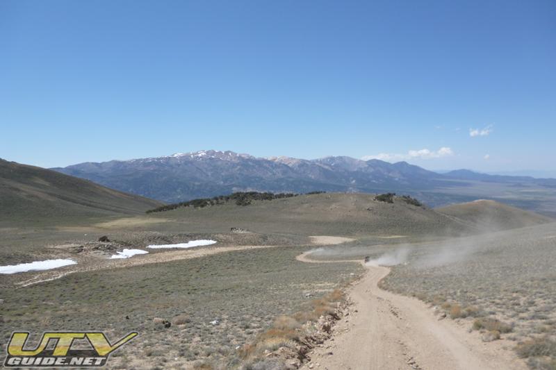
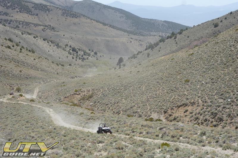
We made our way out past the new Esmeralda Mine and back to the intersection where east takes you to Hawthorne. North to Yerington or west to Sweetwater. Our next destination was Mt. Grant, so we headed north on the graded road towards Yerington. After 5 or so miles, we turned onto an unnamed road (could possibly be Cottonwood Canyon Rd.) that lead us into Baldwin Canyon. This road was on my GPS and topo map, but Dave and John both questioned that several times. The “road” traveled up a wash and was blown out at one point. We found a way around, but it was pretty overgrown and obviously not used very often. We climbed and climbed, then climbed some more.
Once we reached a saddle at top top, we could see the peak of Mt. Grant a few miles away and probably 2,000 ft. higher. We ended up in front of a locked gate. Hmmm. We worked our way along the fence until we found a spot where the wire was cut and hooked back together. We made our way through, then connected the fence back up. The road to the top wasn’t much farther, and we hooked a right and headed UP!

A few miles later, we reached the summit of Mt. Grant at over 11,000 feet (Google Maps) and were rewarded with some incredible views, strong winds and very cool temperatures. Walker Lake and the city of Hawthorne lie somewhere about 7,000 feet below. WOW! We enjoyed the view for a bit, then decided to head down before we turned into popsicles. The road up the to Mt. Grant reminded the climb to Pikes Peak.
Once back off the mountain, we headed north and were looking for a road that would take us back west. After a little bit of searching, we found it, but it wasn’t much of a road. This seemed to be par for the afternoon, so we forged ahead. It turned out to be correct, but I was real happy I had my GPS to back me up.
Once back down on the flat, John ran out of gas. We ran back and dumped 3 – 4 gallons in his RZR XP, then carried on. We reached the road that runs up to Yerington and back down to the intersection near Fletcher. This was real near the Flying-M Ranch which is a several hundred thousand acre property owned by hotel magnate Barron Hilton. We took a left and head back to our camp on graded roads. We did somewhere about 130 miles on this day.
Day Three – Pine Nut Mountains:
Day trip into the Pine Nuts from Smith Valley, Nevada. We drove up Red Canyon (Google Maps) up to Oreana Peak at 9,346 feet (Google Maps). Then towards Gardnerville before heading south and then down Rickey Canyon (Google Maps). Total of about 50 miles with widely varied terrain.
About the Pine Nut Mountains – The Pine Nut Mountains take their name from the Pinion pine that dominate the slopes between 5000-7000 ft. The range starts in the north at the Virginia Range. They continue south for approximately 40 miles where they join with the Sierra Nevada near Topaz Lake and Leviathan Peak (near Holbrook Junction). They are bounded on the west by the Carson Valley and to the east by Mason Valley.
Links:
-
Arctic Cat Wildcat – Overview and Specifications
No Comments