
By Jon Crowley
About the Grand Canyon-Parashant National Monument
“A million of the United States most remote acres without a single paved road.”Grand Canyon Parashant’s natural splendor provides a sense of solitude to those who venture into its isolated domain. Located on the edge of one of the most beautiful places on earth, the Grand Canyon, the Monument’s expansive landscape encompasses a chronicle of natural and cultural history.This Monument is co-managed by the National Park Service and the Bureau of Land Management.The Monument is located on the Colorado Plateau in northwestern Arizona. It borders Grand Canyon National Park to the south, Nevada to the west, and is bounded by the Bureau of Land Management Arizona Strip region on the east and north. There are no paved roads within the Monument. You can access the Monument, via dirt roads, from Nevada, Utah, and Arizona.Before venturing into the Monument, be sure you are well prepared to deal with the rough roads and isolated conditions. There is a great diversity of habitat types in the Grand Canyon-Parashant National Monument, from the 2000 ft elevation hot Mohave Desert creosote bush and Joshua trees, to the Great Basin pinyon-juniper and sagebrush, to the Colorado Plateau grasslands, shrubby red rock desert, and ponderosa pine, gambel oak, and aspen communities on the 8000 ft peaks. Interactive map of the Parashant National Monument Roads in the Grand Canyon-Parashant National Monument are pretty well marked, but there are plenty of roads that are not shown on the NPS/BLM map. Be sure to get a good map of the area if you plan to do much exploring.Your UTV will need to be street legal with proof of insurance to enter the Toroweap area of the Grand Canyon National Park and most of the other roads in the Arizona Strip.
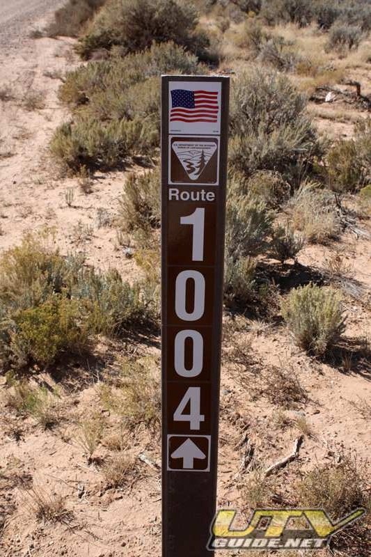
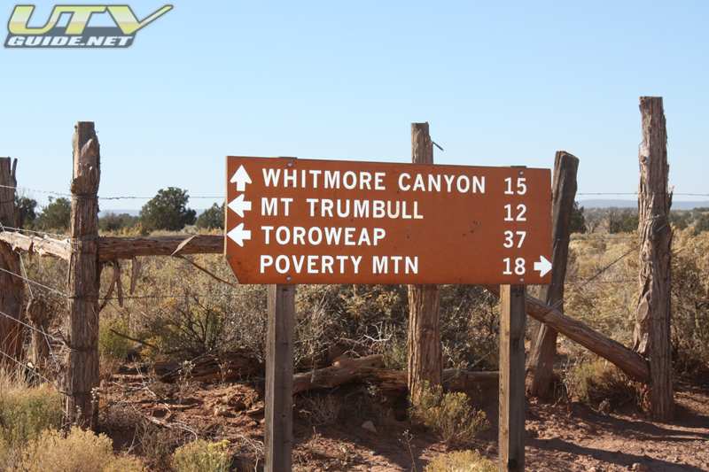
Typical road sign in the Parashant National Monument
There are a few “easy” routes to Toroweap:
- The most popular one begins at AZ 389, nine miles west of Fredonia; turn south 40 miles on County 109, then continue straight 7 miles on County 5, and then straight 14 miles on County 115.
- From Colorado City take County 5 for 44 miles, then continue straight 14 miles on County 115).
- From St. George – on a 90-mile dirt road (BLM Road 1069 and Country 5 for 76 miles, then right 14 miles on County 115).
These more popular routes are easier, and aren’t as scenic as the routes we took in and out. But then again, we were in UTVs that are built for off-road use, and straight graded roads just aren’t that much fun.Day One: Mesquite, NV to Toroweap, AZ
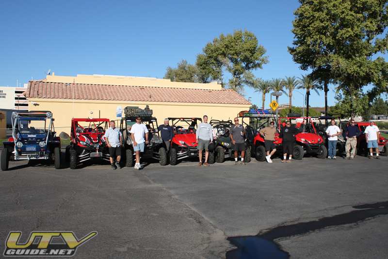
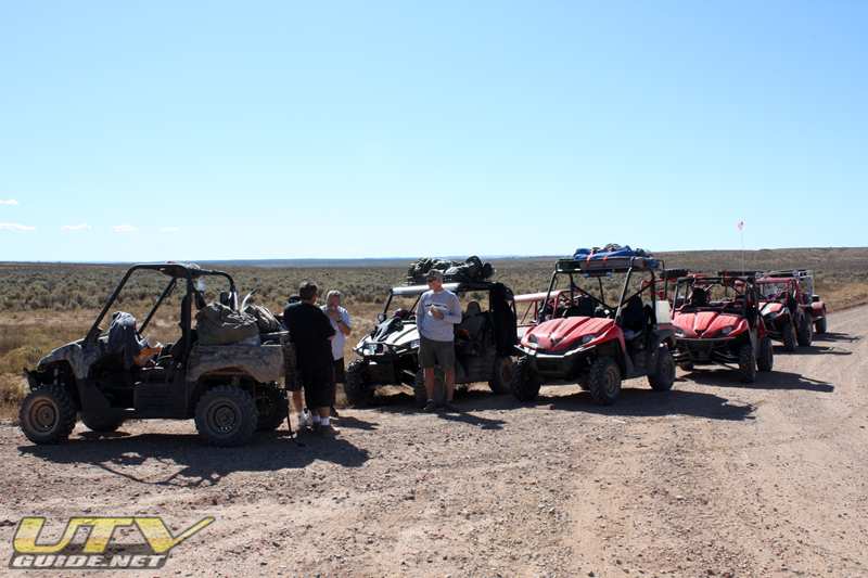
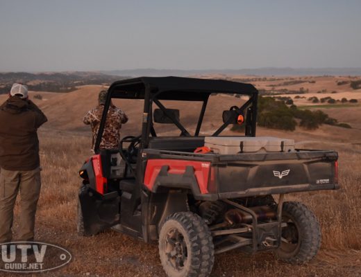
Getting ready to leave Mesquite after topping off with fuel. We started the trip with six Kawasaki Teryxs, two Polaris RZRs and one eight seat buggy.
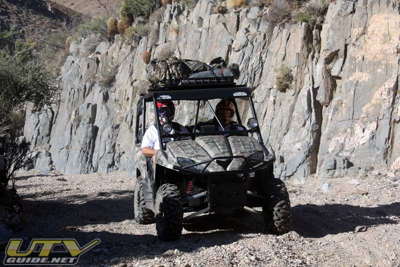
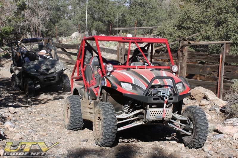
From Mesquite, we worked our way up the rugged canyon on road 299. Just over the top of the pass, we entered the Grand Canyon-Parashant National Monument and the Paiute Wilderness Area. From there we headed east onto road 1004.
Lunch stop – Junction of road 5 and road 1004. Wally’s friend Tom was waiting for us with sandwiches brought from St. George Utah. Tom was driving a Suzuki Samurai.GPS Coordinates: 36°44’49.73″N, 113°32’48.13″W (Google Maps)36 44.856 N, 113 32.801 WAfter lunch we headed south on road 5 (aka Main Street Valley Road) towards Mount Trumbull School. This stretch of the trip was a bit boring. Just a 30 mile high speed run down Main Street Valley and Upper Hurricane Valley on a nicely graded dirt road.
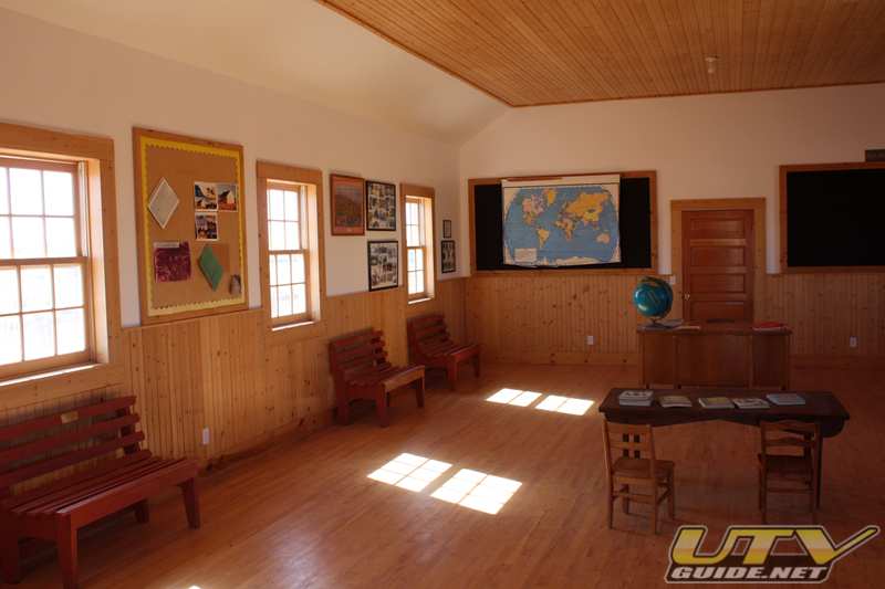
Mount Trumbull School
Inhabitants began arriving in this remote area of northern Arizona (aka the Arizona Strip) around 1917 with dreams of starting their own ranch. The settlers named Mount Trumbull after a nearby mountain. Each homesteader received 640 acres of land for raising livestock. Residents grew crops, but the dry climate and lack of well water made farming very difficult. Mount Trumbull and the surrounding area grew to a peak population of 200-250 in the 1930’s.Townspeople completed the Mount Trumbull School in 1922 and served for 80 years as a landmark and gathering place for the pioneer families and their descendants who farmed and ranched on the high plateau.The schoolhouse was burnt down long ago, but a replica of the building now stands in its place.
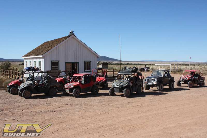
The schoolhouse is located at the junction on road 5, road 1018, and road 1045, approximately 60 miles from St. George.GPS Coordinates: 36°24’42.58″N, 113°19’32.81″W (Google Maps)
Junction Road 5 and Road 115Road 5 meets up with road 115, and we head south about 13 miles on road 115 towards Toroweap Campground. GPS Coordinates: 36°24’55.82″N, 113° 3’44.37″W (Google Maps)36 23.326 N, 113 03.576 WMap of Tuweep, AZ by MapQuest – Aerial image is better than Google Maps in this area.
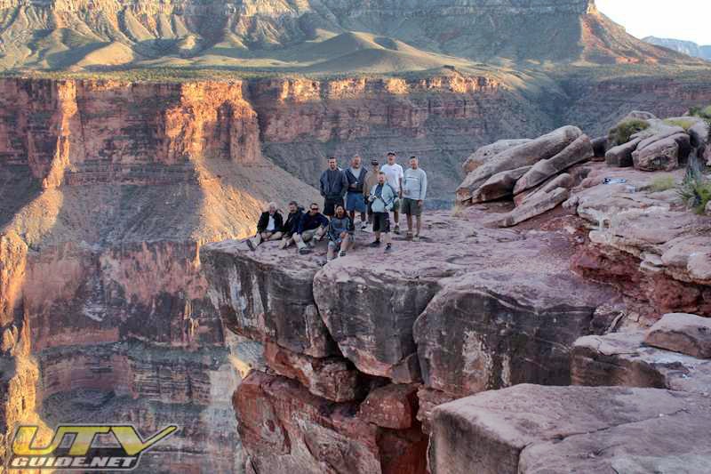
Toroweap Campground and OverlookThe National Park Service manages the area for its primitive values, so improvements and services are minimal. Fire rings, picnic tables and composting pit toilets are provided, but no electricity or water is available.Ten primitive sites for 1-6 people are available on a first-come first-served basis. One group site for 7-11 people is available via reservation only.Toroweap Campground GPS Coordinates: 36°13’30.62″N, 113° 3’37.65″W (Google Maps)The Toroweap Overlook sits 3,000 vertical feet above the Colorado River, and offers an incredible view of the Grand Canyon and the river below. If you are scared of heights, beware! You won’t find any railings or blockades to keep you from falling. It is less than one mile across the canyon to the Hualapai Indian Reservation on the South Rim, making this one of the narrowest and deepest segments of the inner canyon.Toroweap Overlook GPS Coordinates: 36°12’53.00″N, 113° 3’25.00″W (Google Maps)
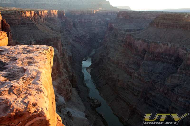
View from the Toroweap Overlook Tuweep sits at an elevation of 4600 feet.
Day Two: Toroweap Campground to Bar 10 Ranch, Whitmore Canyon Overlook and back
All the rigs getting ready to leave Toroweap CampgroundTo get to the Bar 10 from Toroweap, we took a shortcut throughMt. Logan Wilderness Area. The cherry-stemmed 4WD route was open, but lands on both sides of us were closed to vehicles.We left camp and headed back up road 115, then west on road 5 (may be known as Mt. Trumbull Road in this area). About 3 miles up road 5 we turned south onto road 1028. Just down road 1028 a bit is the turnoff to the Nampaweap Rock Art site. We did not take the time to check this spot out, but I would do so if I get there again. From here, things get a bit tricky. The most direct route leads to a locked gate and private property (I believe it is road 123). We found our way around this, but you really should have a GPS to follow our route.
GPS Coordinates:
- 36° 21′ 59.10″N, 113° 6′ 21.42″W (Google Maps) – Road 5 and 1028 (Nampaweap Rock Art Site)
- 36 21.353N, 113 07.232W – Right turn on 1028
- 36 21.115N, 113 08.722W – Right turn on 1029
- 36 21.248N, 113 09.359W on trail
- 36 21.837N, 113 09.978W – Left turn 1047
- 36 21.864N, 113 10.131W – on trail
- 36 20.972N, 113 11.381W – Left on 1044
- Trail turns into 1023
- 36 20.028N, 113 10.058W – Right turn
- 36 19.618N, 113 10.62W – Bear right
- 36 19.900N, 113 10.876W – Head west
- 36 19.951N, 113 11.113W – Turn left
- 36 19.479N, 113 11.527W – Right turn
- 36 19.043N, 113 13.026W – Leaving Mt. Logan Wilderness Area (legal OHV route)
- 36 18.769N, 113 13.351W – Left turn
- 36 18.584N, 113 13.283W – Bear right
- 36 16.963N, 113 14.026W – Intersection of 1045 and 123 – go straight

Making our way through Mt. Logan Wilderness on a legal cherry stemmed OHV route.The area leading to Mt. Logan includes basalt ledges, Ponderosa pine forests, Pinyon-Juniper, and cinder cones.At the bottom of the hill, we turned south onto road 1045 to finish up the ride to Bar 10 Ranch.
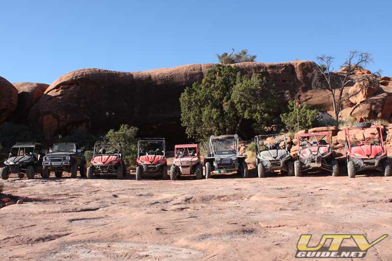
Arriving at Bar 10 Ranch
Bar 10 Ranch
Bar 10 Ranch is a full service ranch located on the north rim of the Grand Canyon, in the heart of Grand Canyon Parashant National Monument. There is plenty to see and do at the Bar 10 Ranch. Guests are treated to country-style buffet meals, and evening entertainment that brings the West alive. A variety of ranch activities and horseback riding is available, and tours may include guided UTV and ATV rides. The Bar 10 is still a working cattle ranch, so visitors can get a taste of that life as well, with demonstrations of real ranching operations such as branding and roping.There are plenty of beautiful trails that are accessible from the Bar 10 Ranch, and fuel is available for your UTVs. Be sure to call ahead to reserve what you need.Bar 10 Ranch GPS Coordinates: 36°16’44.80″N, 113°13’57.32″W (Google Maps)
Whitmore Canyon Overlook
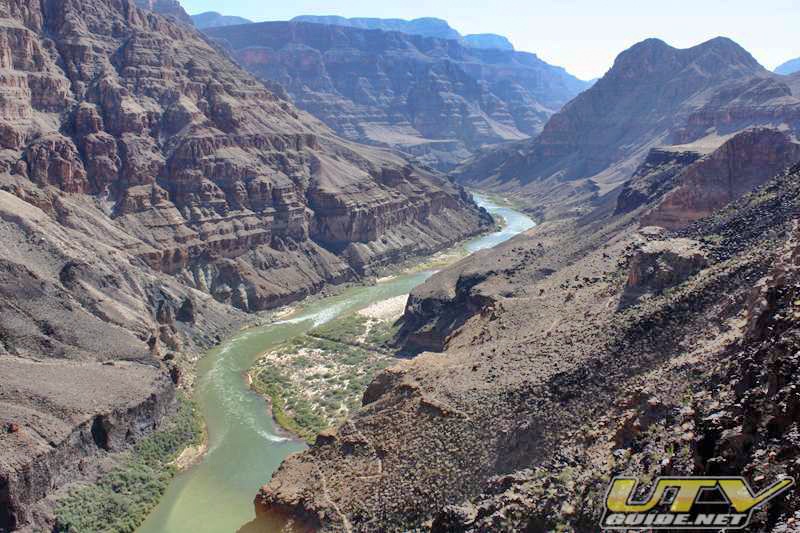
GPS Coordinates: 36° 8′ 59.28″ N, 113° 12′ 18.48″W (Google Maps)The trail to the river from the overlook is about a mile and goes from 2,500 feet at the overlook to 1,500 feet at the river. Much less of a hike that the hike from Toroweap down.
Day Three: Toroweap Campground to Mesquite, NVOn the way back to Mesquite, we took a different route once we reached the Mt. Trumbull Schoolhouse. None of us had been this route, but it was a great decision to try something new. The scenery was incredible and the riding was a lot of fun.At the schoolhouse, we took road 1018 heading west. We skirted the south side of Poverty Mountain.
GPS Coordinates for our route out to Mesquite:
- 36 23.662N, 113 34.77W – Turn north road 1003 (Hidden Canyon Road) down through Hidden Canyon.
- 36 24.600N, 113 34.980W – continue north and stay on road 1003 (road may be called Nutter Twists Rd.)
- 36 26.125N, 113 35.414 W – bear right and stay on road 1003
- 36 27.711N, 113 36.650 W – left turn and stay on 1003
- 36 29.436N, 113 39.542 W – bear right (in Rattlesnake Canyon)
- 36 31.140 N, 113 40.258 W – bear left and stay on 1003 (in St. George Canyon)
- 36 32.128 N, 113 44.095 W – straight and stay on 1003
- 36 30.592 N, 113 52.304 W – bear right and stay on 1003

From road 1003 we turned onto left on Road 1007.
- 36 30.588 N, 113 52.300 W – turn right on 1027
- 36 30.754 N, 113 52.511 W – bear left
- 36 30.309 N, 113 53.425 W – bear right
- 36 32.053 N, 113 54.711 W – bear right (Cottonwood Wash)
- 36 36.438 N, 113 57.757 W – Road 1027 turns into Road 242 at the intersection of Road 101.
Road 242 through Lime Kiln Canyon out to Mesquite.
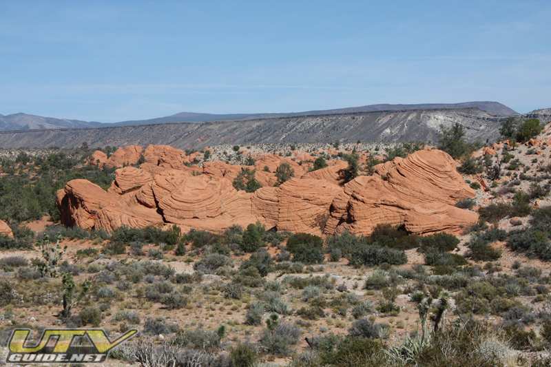
“Beehive” rocks near the Valley of Fire
Wilderness Areas:
- Paiute Wilderness Area – In the northwest corner of Arizona is an 84,700-acre area called Paiute Wilderness. The rugged terrain reaches 8,012 feet on Mount Bangs.
- Grand Wash Cliffs Wilderness Area is a remote 37,030 acre wilderness area.
- Mount Trumbull Wilderness Area is a 7,900 acre wilderness area with Mount Trumbull reaching a peak of 8,028 feet at its highest point.
- Mount Logan Wilderness Area is a14,650-acre wilderness lies 45 miles south of Colorado City, Arizona, just north of the Grand Canyon in Mohave County.
Travel Warning:
Be aware that the Arizona Strip is a remote and undeveloped region. The zones along these routes have no services available. Make sure you have adequate fuel and lots of water before beginning your trip.Segments of the roads described here are winding, rough and rocky. Motorhomes and travel trailers are not recommended. A high-clearance vehicle is recommended. Four-wheel drive may sometimes be necessary. Motorized vehicles must remain on existing roads and trails. The roads are unpaved and in wet weather can become muddy and dangerous. We advise visitors to prepare for bad weather as the Strip is not patrolled on a regular basis.If your vehicle breaks down along some of these routes, you may be on your own for some time. Before starting out, tell someone where you are going and what time you expect to return.Road numbers have been posted at intersections and correspond to the BLM Arizona Strip Visitor’s Map, for sale at the office in St. George.Public lands throughout the area are open for camping. There is a fourteen-day maximum stay limit. BLM does not require fees or permits for backcountry camping and the State of Arizona requests that you do not camp within one-fourth mile of any watering device or reservoir.Your UTV will need to be street legal to enter the Toroweap area of the Grand Canyon National Park and most of the other roads in the Arizona Strip.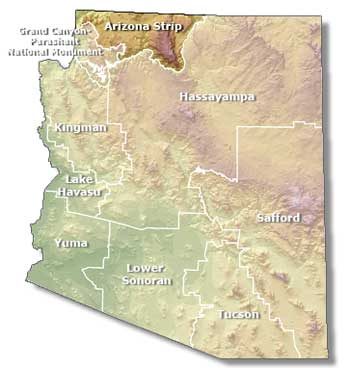
Bureau of Land Management – Arizona Strip Field Office
345 E. Riverside Dr.
St. George UT 84790
435-688-3200
Links:
No Comments